OOF2: The Manual
| GistEarth (GistEarth) | ||
|---|---|---|

|
6.5.2. Subclasses |  |
Name
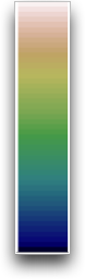
GistEarth (GistEarth) — Geographically inspired topography-like color scheme.
Synopsis
GistEarth()
Description
ColorMaps
translate numbers into colors, for use in contour plots.
GistEarth uses a geographically inspired
color sequence, from dark blue at the bottom, representing water,
through green, beige, and finally white at the top, representing
snow-covered mountains. The resulting contour plots resemble
topographical maps. The name comes from the GIST software
for viewing GIS data, which popularized this scheme.
|
|
 |
|
| Graphics Window (GfxWindowDestination) |  |
Global (GlobalErrorScaling) |